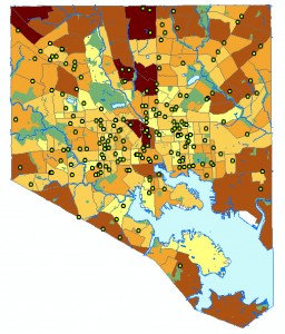
 Identifying and mapping business locations is one of the most frequent activities embarked upon by geographic information system (GIS) users doing location analysis. Where are the food stores, restaurants, cemeteries, gyms, tattoo parlors, or medical marijuana clinics? Does the proximity of certain business type have a negative or positive impact on the surrounding area? What patterns become apparent when mapping businesses locations in combination with consumer expenditures, income, or other demographic data? All of the above is just one visualization away using the power of GIS in combination with the library subscription database ReferenceUSA.
For starters, think of ReferenceUSA as a giant spreadsheet containing over 24 million active business entries. Standard variables on the spreadsheet include company name, address, business type, estimated sales volume, number of employees, and associated industry classification codes (SIC and NAICS).
Extracting just the needed businesses, by type or geographic area, is easy with available search templates, and a variety of output options. GIS users will likely choose the CSV (comma-separated values) download as it provides greater flexibility for mapping using the included latitude/longitude coordinates or via the GIS process called address geocoding.
If tracking the geographic comings and goings of businesses is needed, ReferenceUSA offers a subcomponent titled “U.S. Historical Businesses” with 151 million business location entries extending back to 2003. Also included is the spreadsheet variable indicating the years each business appeared in the active businesses portion of the database.
Looking for help getting started with ReferenceUSA, ArcGIS desktop software or ArcGIS Online for Johns Hopkins? Talk to the folks in GIS and Data Service (A-Level of the Eisenhower Library building), send us an e-mail at GISandData@jhu.edu or give us a call at 410-516-8360.
