 The Sheridan Libraries GIS and Data Services Department is resuming its popular series of workshops, “Getting Acquainted With ArcGIS”!
From introductory classes, through design, sharing, data selection, and georeferencing, students learn and share ideas about how to present data in visual form.
All classes will be held from 4-5:30 pm on A-level. Our weekly workshops schedule is as follows:
Introduction to GIS
September 16
Get started with ArcGIS, the most popular and widely available GIS software. In this first session you’ll navigate and become acquainted with the ArcMap interface, geospatial data, key software features and functions, and how to get started creating maps.
Map Design in GIS
September 23
This workshop will focus on visualizing data on the map. You’ll learn how to use symbols, colors, and data classification to portray data and convey your message via a meaningful map.
GIS Outputs
September 30
Learn to use map layouts, create map templates, and add graphs, charts, and animation to your map. You’ll practice outputting your creation as map images or as a package of geospatial data with full attribute content that you can use and share with others.
Introduction to ArcGIS Online
October 7
Explore with us one of the newest ArcGIS resources for identification and downloading GIS data. Learn about some of the time series data that the library created, as well as ready-to-go data available as part of our ArcGIS license.
Overview of Geospatial Data Sources
October 14
Learn about the vast array of geospatial subscription data available via some of our most popular library databases. Understand the tips and tricks for reformatting subscription database information for inclusion in your ArcGIS projects.
Joining and Geocoding
October 21
Learn the steps required for successful joining of data and geocoding along with tips and suggestions for preparing data for use with ArcGIS. Common file formats will be discussed, (e.g. Excel, dBase, Access), along with text files and data with x, y coordinates. We’ll explore street files available from the library along with optional interfaces for the geocoding process.
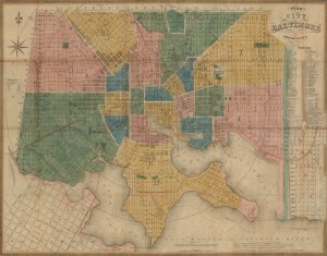
Georeferencing
October 28
Scanned maps and aerial photos can offer historical enhancement to your ArcMap projects. Georeferencing is the process of accurately aligning a scanned image with vector data found in ArcGIS. In this session you’ll learn about the various techniques for making that alignment using scanned images from the library’s collection.