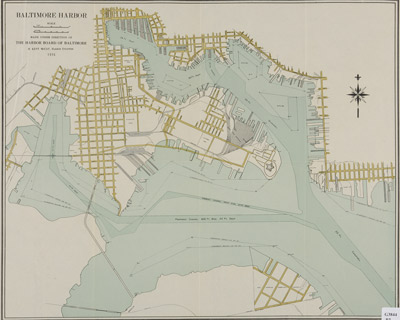
 Map Display Provides Window to Baltimore’s Past
Baltimore’s straight-line boundaries, vertical orientation, and variety of water features are the perfect elements for great graphical presentation.
Baltimore: A Cartographer’s Delight features Baltimore city maps from the Sheridan Libraries’ extensive collection of more than 215,000 maps. Part of the Baltimore Festival of Maps, the exhibit opens March 26 on the M-Level of Homewood’s Milton S. Eisenhower Library. On display are maps dating from the mid-19th to the 20th century, highlighting the city’s growth and development and its rail and trolley systems. Also featured are early design plans for the university’s East Baltimore and Homewood campuses.
“We are delighted to provide insights into Baltimore’s rich history through our selection of city maps,” said James Gillispie, head of the Government Publications/Maps/Law Library at the Sheridan Libraries, and curator of the exhibition. “And we have just launched a website to provide a guide to all of our historic maps, with an emphasis on maps relating to Maryland,” he said. The historic collection includes road maps, souvenir and tourist maps, and topographical maps.
The Eisenhower Library display runs through August 18, and may be viewed Monday through Thursday from 8 a.m. to midnight, Friday and Saturday from 8 a.m. to 10 p.m., and on Sunday from 10 a.m. to midnight.
The Baltimore Festival of Maps, a citywide celebration of mapping, runs from March 15 through June 8 with more than 45 exhibitions, tours, seminars, performances, lectures, hands-on activities, workshops and films. For a schedule of Baltimore Festival of Maps activities, visit http://www.BaltimoreFestivalofMaps.com
